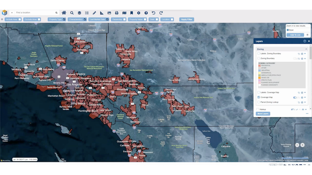
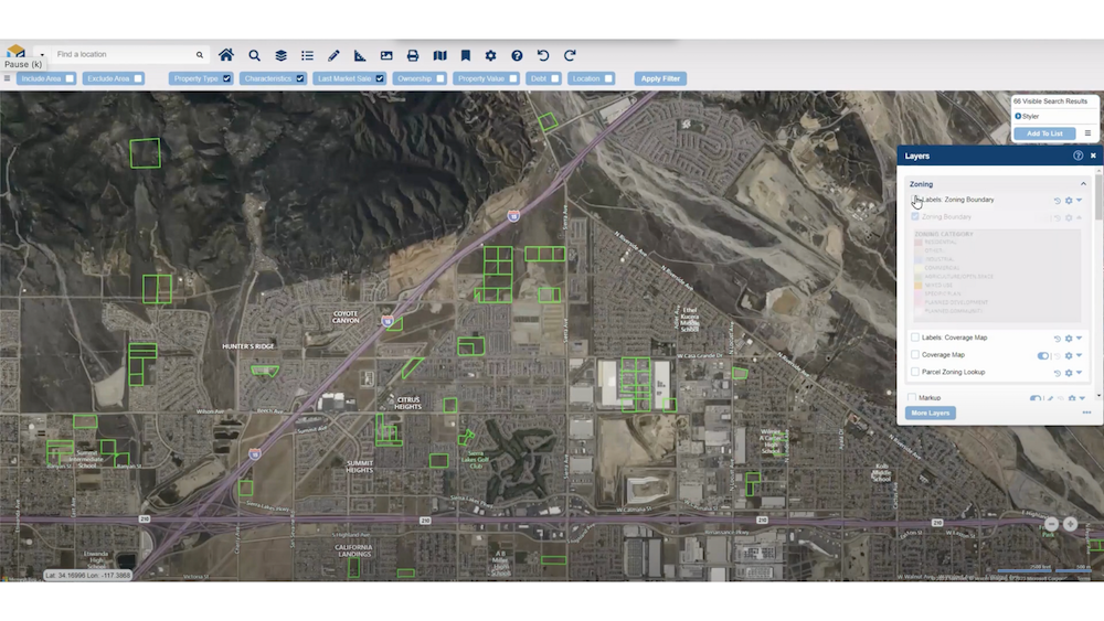
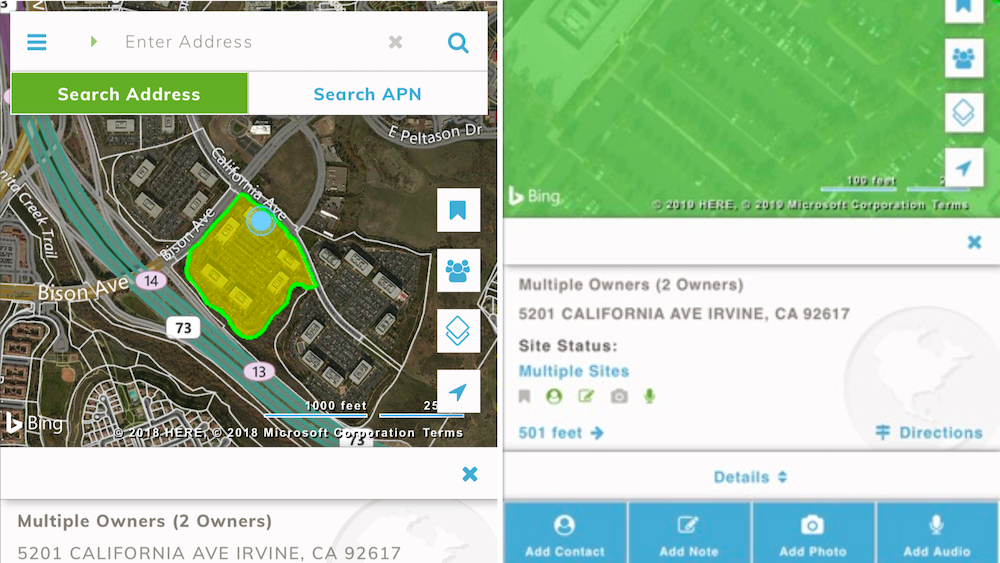
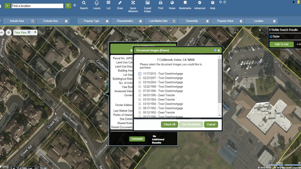
LandVision is a cloud-based mapping tool designed for real estate professionals and government agencies. It offers advanced mapping and spatial analysis features that help users make informed decisions. With detailed information on property ownership, flood zones, and nearby demographics, LandVision acts like an enhanced map, giving users the essential data they need.
This platform is especially useful for real estate agents, builders, and city planners. It provides clear satellite images and historical data to track changes over time, making it easier to analyze land and property. LandVision also keeps users updated on market trends, allowing them to respond quickly to changes.
Key Takeaways
- LandVision is aimed at real estate professionals and government agencies.It provides advanced mapping, property research tools, and integration capabilities.
- The platform has an intuitive interface. LandVision helps users make informed decisions with detailed data and analytics.
- LandVision alternatives like Mapbox, Google Maps, ArcGIS, and QGIS may better suit different user needs.
Understanding LandVision: A Comprehensive Overview
LandVision is a cloud-based mapping tool made for the real estate and government sectors. It functions like a supercharged map, providing essential information like property ownership, flood zone locations, and nearby population data.
Real estate professionals, builders, and city planners find this software very helpful because it offers clear satellite images of land and historical data to track changes over time.
To truly understand this tool, you need to explore its advanced features. Imagine being able to analyze the surroundings of a piece of land right from your desk! LandVision also keeps users informed about market changes, helping them make quick and smart decisions.

What LandVision Is and Its Place in the Market
LandVision occupies a unique spot in the market as a powerful cloud-based mapping platform designed for the real estate and government sectors. It effectively combines detailed parcel mapping with property analysis tools, providing thorough visualizations of ownership information, zoning details, and more.
Users gain access to valuable features that highlight environmental risks, demographic information, and high-resolution aerial images. This technology simplifies property research and improves decision-making through advanced data integration.
As a practical solution in the constantly changing field of location intelligence platforms, LandVision serves professionals who need accurate and detailed analysis for their work.
Benefits of LandVision for Real Estate and Government Sectors
LandVision is a versatile tool for professionals in real estate and government sectors looking for comprehensive geographic information system (GIS) capabilities. Real estate brokers use this platform to quickly explore extensive property databases, analyze detailed parcel boundaries, and discover valuable ownership information.
This GIS expertise helps them find prime properties that fit specific zoning laws while integrating environmental data into their decision-making process.
Government agencies also benefit from LandVision’s dynamic features. They can access up-to-date aerial imagery, which is essential for urban planning and emergency response efforts.
With demographic data visualization available, they can effectively assess community needs and improve policy decisions based on solid market trend analysis. By employing such profound government property research tools, city planners and public officials can create well-informed land management solutions that better serve the community.
Key Features of LandVision
LandVision offers advanced mapping and spatial analysis tools, as well as strong property research and due diligence features. Its ability to integrate with other software makes it a flexible solution for both the real estate and government sectors.
Advanced Mapping and Spatial Analysis
Advanced mapping and spatial analysis stand as key features, positioning LandVision at the forefront of GIS technology. Users unlock a powerful suite of tools designed for comprehensive environmental data management, enriched with high-resolution aerial imagery.
The software’s advanced spatial visualization technology empowers users to layer geographic data in ways that bring clarity to complex land patterns and relationships.
Moreover, property analytics become streamlined through LandVision’s timeview capabilities and market trend insights. Geospatial professionals can set alerts based on specific criteria within this intuitive platform, enhancing their ability to make informed decisions.
Whether assessing real estate developments or planning urban infrastructure, these mapping solutions offer precise location intelligence indispensable for today’s geographically-driven business landscape.

Property Research and Due Diligence Tools
LandVision offers powerful property research and due diligence tools, empowering users to make informed decisions in real estate transactions. With access to parcel boundaries, ownership information, zoning, and land use data, as well as environmental and natural hazard details, users can conduct comprehensive property analysis with ease.
The platform also provides high-resolution aerial imagery and satellite mapping for accurate visual representations of properties. Besides, LandVision’s market trends and alerts feature keeps users updated on the latest developments, ensuring they stay ahead in the competitive real estate landscape.
Furthermore, its GIS capabilities enable advanced spatial analysis for thorough property assessment. This comprehensive suite of property research tools equips professionals in the real estate industry with the necessary insights to streamline their due diligence processes effectively.

Integration Capabilities with Other Software
LandVision offers integration with various third-party applications, ensuring compatibility and data sharing across platforms. Its collaborative software solutions enable cross-platform functionality, allowing for the exchange of data and connectivity with other systems.
Despite not having an available API, LandVision’s interoperability with other software provides users with the ability to leverage its advanced mapping and spatial analysis alongside their existing tools.
The software’s connectivity options demonstrate its commitment to facilitating a smooth exchange of information between different platforms, enhancing overall efficiency for real estate professionals and those working in government sectors.
In-Depth Look at LandVision Pricing
LandVision offers a subscription-based pricing model designed to fit different user needs in the real estate and government sectors. The software provides a free trial, allowing potential users to explore its features before making a financial commitment.
For full access, users can request detailed pricing information directly from the LandVision sales team. This means that you can get a pricing plan that suits your specific needs and budget. The pricing is flexible and designed to cater to both small teams and larger organizations.
When evaluating pricing, it’s essential to consider what features are most important for your work. For example, if you need advanced mapping tools or access to demographic data, you may want to look at higher tiers. On the other hand, if you’re just starting out or have basic needs, the lower-priced plans could be a good fit.
User Reviews and Feedback on LandVision
Users have praised LandVision for its intuitive interface and robust mapping and spatial analysis capabilities. They have also highlighted the platform’s property research tools as invaluable for their real estate and government projects.
Pros of LandVision
LandVision has many advantages that make it a strong choice for real estate professionals and government agencies. First, it offers powerful mapping and analysis tools that help users understand property details and land features easily. The platform provides high-quality satellite images and up-to-date information, making it simple to visualize properties and their surroundings. This is especially useful for real estate agents who need to find the right properties for their clients quickly.
Another big plus is LandVision’s user-friendly interface. Users can navigate through the software without much hassle, which saves time and makes the learning process smoother. The availability of a free trial allows potential customers to test the platform before committing, giving them the chance to see how well it meets their needs.
Additionally, LandVision’s integration capabilities with other software tools enhance its functionality, allowing users to combine different data sources for better insights.

Cons of LandVision
While LandVision has many benefits, there are some drawbacks to consider. One common concern is the pricing structure. Some users find that the cost can be high, especially for smaller organizations or individuals with limited budgets. Although the platform offers a free trial, accessing all features requires a paid subscription, which may not be affordable for everyone.
Another issue is that some users have reported challenges with system integration. While the software can connect with other tools, there may be difficulties or limitations when trying to sync data.
Besides, language options may be limited, making it harder for non-English speaking users to navigate the platform fully.
LandVision Alternatives for Different User Needs
When searching for location intelligence platforms, LandVision is a popular choice, especially for real estate professionals. However, different users have different needs. Here are some alternatives that might be a better fit for certain situations.
| Platform | Best For | Key Features | Pricing |
|---|---|---|---|
| LandVision | Real estate professionals | Map overlays, property data, GIS tools | Subscription-based |
| Mapbox | Custom mapping solutions | Customizable maps, extensive API, real-time data | Pay-as-you-go |
| Google Maps Platform | General mapping needs | Street view, directions, location data | Pay-as-you-go |
| ArcGIS | Advanced GIS analysis | Spatial analysis, data visualization, collaboration tools | Subscription-based |
| QGIS | Open-source GIS projects | Custom plugins, data editing, user-friendly | Free |
- LandVision is best suited for real estate professionals. It provides detailed property information and useful mapping tools. Users can access map overlays, property data, and Geographic Information System (GIS) tools.
- Mapbox is ideal for those who want customizable mapping solutions. It’s great for app developers and businesses that need unique maps for their services. Mapbox offers customizable maps and an extensive API, which allows users to integrate maps into their applications easily. It also provides real-time data updates, making it a flexible option.
- Google Maps Platform is a good choice for general mapping needs. It is widely used by businesses for location data and navigation solutions. Google Maps offers features like street view, directions, and extensive location data.
- ArcGIS is the right platform for users who need advanced GIS analysis. It is suitable for professionals who want to perform in-depth spatial analysis and create strong data visualizations. ArcGIS includes collaboration tools that allow teams to work together effectively.
- QGIS is an excellent choice for users looking for open-source software for their GIS projects. This platform is perfect for non-profits or students who need basic GIS functionality. QGIS offers custom plugins and powerful data editing options. It is user-friendly, making it accessible to users of all skill levels.
Choosing the right location intelligence platform depends on your specific needs. LandVision is great for real estate applications, while Mapbox and Google Maps provide broader mapping features. ArcGIS is best for advanced analysis, and QGIS is a budget-friendly option for basic GIS tasks.
Is LandVision the Right Choice for You?
LandVision is a flexible location intelligence platform that works well for real estate professionals and government agencies. Its advanced mapping tools, property research features, and ability to integrate with other software make it a valuable choice for anyone looking for efficient and thorough spatial analysis.
The integration capabilities of LandVision help streamline workflows and improve location-based analytics. With a focus on user-friendly interfaces and customizable features, LandVision is an effective solution for professionals needing powerful geographic information systems (GIS) tailored to their specific needs in the real estate and government sectors.
Overall, LandVision provides a complete solution for real estate professionals and government agencies, offering advanced mapping, property research, and integration capabilities.
Frequently Asked Questions
What is LandVision?
LandVision is a comprehensive mapping and property research tool used by real estate professionals for visualizing and analyzing land-related information.
How can I check the latest pricing for LandVision?
To check the latest pricing for LandVision, you can visit their official website or contact their sales team directly.
What are the key features of LandVision?
Key features of LandVision include property parcel data, custom map overlays, advanced search capabilities, market trend analysis, and collaboration tools.
Can I explore alternatives to LandVision?
Yes, there are alternative platforms available in the market such as Mapbox, Google Maps, ArcGIS, and QGIS.
Is training provided for using LandVision effectively?
Yes, there are training resources available including tutorials, webinars, and customer support to help users effectively utilize all aspects of LandVision.


